| [ Login ]/[ Register ] |
 Search ::
  My Data Basket ::
  Favorite/My Favorite :: Recent Changes :: :: Login Save in Data Basket ]
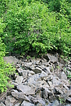
| Caption:四道河子长城 Photo Time:2007-05-22 16:56:21 Photo Contributor:辽宁省文物局 [Open in New Window] |
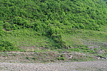
| Caption:四道河子长城 Photo Time:2007-05-22 16:38:09 Photo Contributor:辽宁省文物局 [Open in New Window] |
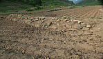
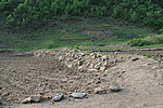
| Caption:四道河子长城 Photo Contributor:辽宁省文物局 [Open in New Window] |
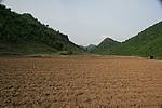
| Caption:四道河子长城 Photo Time:2007-05-22 16:42:59 Photo Contributor:辽宁省文物局 [Open in New Window] |
| Caption:四道河子长城 Photo Time:2007-05-22 16:40:24 Photo Contributor:辽宁省文物局 [Open in New Window] |