| [ Login ]/[ Register ] |
 Search ::
  My Data Basket ::
  Favorite/My Favorite :: Recent Changes :: :: Login Save in Data Basket ]
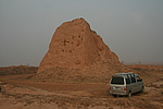
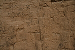
| Caption:韩家营5号烽火台 Photo Time:2007-11-06 08:54:55 Photo Contributor:内蒙古自治区文物局 [Open in New Window] |
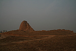
| Caption:韩家营5号烽火台 Photo Time:2007-11-06 08:55:59 Photo Contributor:内蒙古自治区文物局 [Open in New Window] |
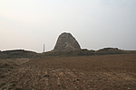
| Caption:韩家营5号烽火台 Photo Time:2007-11-06 08:58:03 Photo Contributor:内蒙古自治区文物局 [Open in New Window] |
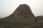
| Caption:韩家营5号烽火台 Photo Time:2007-11-06 09:00:04 Photo Contributor:内蒙古自治区文物局 [Open in New Window] |
| Caption:韩家营5号烽火台 Photo Time:2007-11-06 09:01:07 Photo Contributor:内蒙古自治区文物局 [Open in New Window] |