| [ Login ]/[ Register ] |
 Search ::
  My Data Basket ::
  Favorite/My Favorite :: Recent Changes :: :: Login Save in Data Basket ]
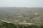
| Caption:南梁上2段长城 Photo Time:2007-08-25 15:03:23 Photo Contributor:山西省文物局 [Open in New Window] |
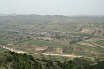
| Caption:南梁上2段长城 Photo Time:2007-08-25 15:03:30 Photo Contributor:山西省文物局 [Open in New Window] |
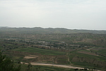
| Caption:南梁上2段长城 Photo Time:2007-08-25 15:30:00 Photo Contributor:山西省文物局 [Open in New Window] |
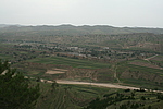
| Caption:南梁上2段长城 Photo Time:2007-08-25 15:29:52 Photo Contributor:山西省文物局 [Open in New Window] |